GR 28 – THROUGH HILLS AND VALLEYS OF AROUCA
GR - Grande Rota
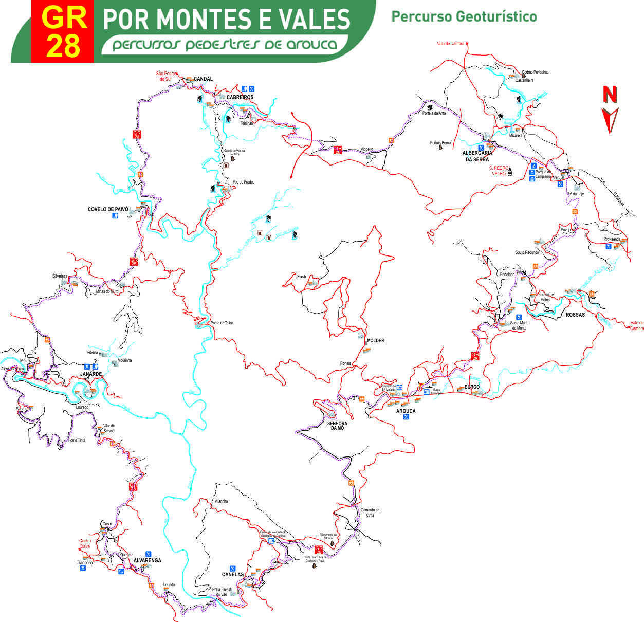
This is the Long Distance Route of the Arouca Geopark. You can take about 4 days to complete it, crossing the valley of Arouca, the Freita and Arada Mountains and the valleys of the Paivô and Paiva rivers. Throughout of about 85 kilometers, that connect a great number of Geosites, the extraordinary landscapes, the villages of the mountain, the watercourses, everything will appear in a surprising way. More than describing it, it is imperative to walk through this GR (Long distance route).
Departure and arrival: Arouca (Municipal Museum)
Type of route: Long distance route by rural, traditional and mountain paths
Distance to go: 90 000 m (circular)
Duration: About 4 days
Level of difficulty: Medium
Gaps: Moderately accented
Advised season: All the year
Other points of interest: Merujal villages, Picnic park of Vale da Raíz.
 Route characteristics
- Starting point:Museu Municipal de Arouca
- End point:Museu Municipal de Arouca
- Distance:90.00 km
- Degree difficulty:Médio
- Duration:96.00 h
 downloads