Geosite 38 Mira Paiva
Glimpsing the Paiva…
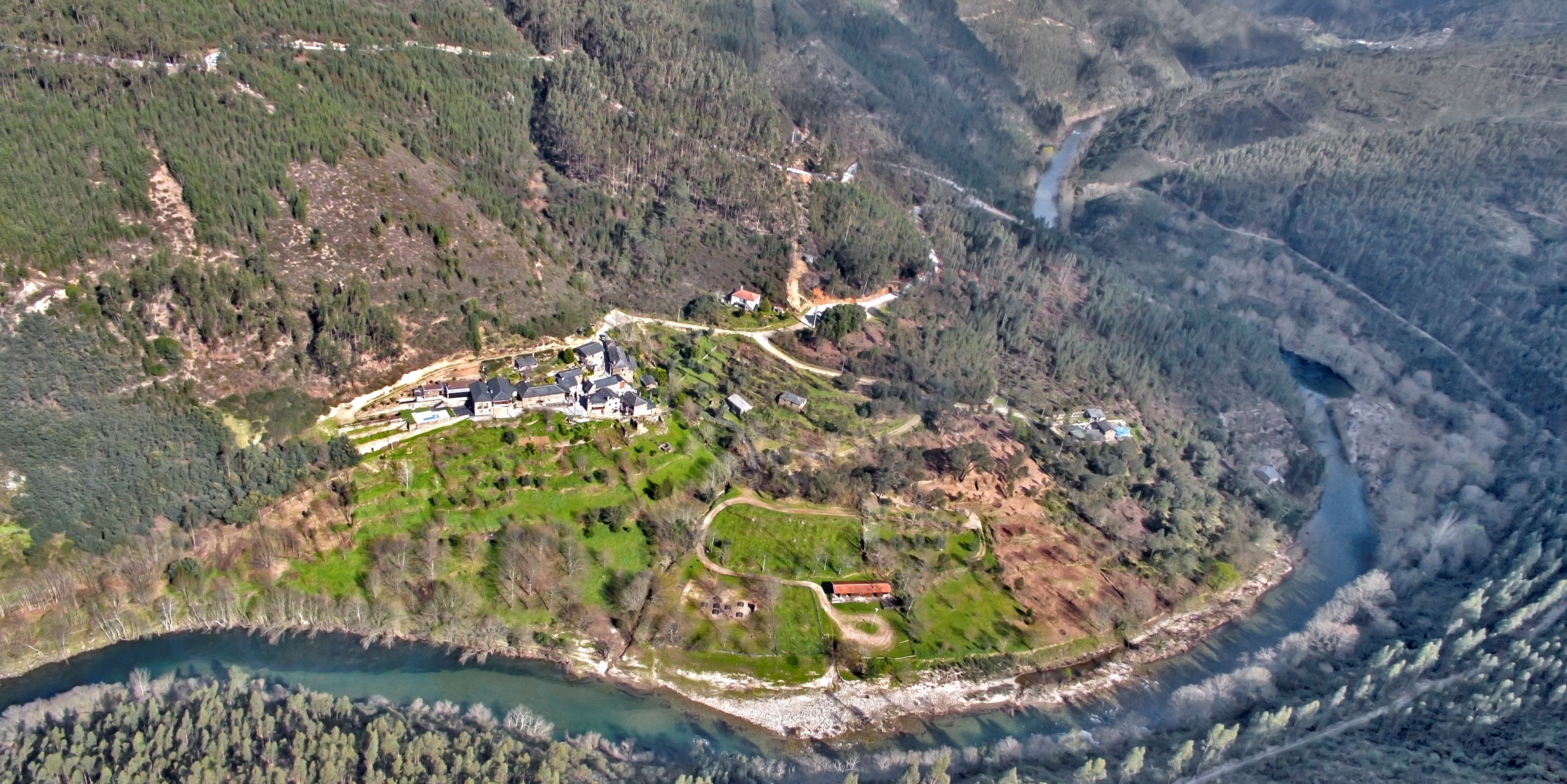
This geosite includes the Mira Paiva panoramic point and the entire area up to the right bank of the Paiva River. From this highly scenic spot, you can see the Paiva river valley and the schist village of Paradinha, classified as a “Village of Portugal”.
The Paiva river rises in the Serra de Leomil, in Moimenta da Beira, and runs for around 110 km until it flows into the Douro river, between the municipalities of Castelo de Paiva and Cinfães. Over the last two million years, the Paiva River has shaped the landscape. It has torn and sculpted the banks of the valley, transforming it into the main barrier between the Montemuro mountain range and the Gralheira massif (Freita, Arada and Arestal mountains).
At this geosite, at the bottom of the valley, the Paradinha recreational and leisure area invites you to enjoy the waters of this river. Here we come across a huge quantity of blocks, pebbles and sands. These deposits are called sediments and are the most recent rocks in the UNESCO World Geopark of Arouca. Different in composition and color, they reflect rocks such as schist, granite and quarzite, among others, which the river intersects and tears away as it passes. The rounder they are, the longer they have been transported, so many of the sediments come from far away. This viewpoint is also ideal for watching adventure sports on the River Paiva, particularly the whitewater trail that stretches from Meitriz to Areinho, which is considered to be of a low degree of difficulty (level I/II, on a scale of I to VI).
This geosite is part of the itinerary C: Paiva, O Vale Surpreendente.
Learn more about the Geosites Route .
Geological Information
The river embraces the recreational and leisure area next to the village in a convex shape. In fact, the current is stronger on the concave bank, eroding it more than the convex bank, where it deposits part of its solid load. For this reason, on the convex bank (and, in this case, on the right bank) you can see a fluvial area formed largely by loose pebbles, of various origins, but floated by the river, which in themselves tell the geological story of the region. It is also possible to see downstream the mouth of the Paivô River, which drains a significant part of the southwest area of the Arouca Geopark. The region is covered by the Douro Hydrographic Basin. The Mira Paiva site is also recognized for its value from a paleontological point of view. In 2010, fieldwork was carried out that allowed numerous plant fossils to be collected in Carboniferous rocks, proving the complexity of the Douro Carboniferous Basin.
Interests
Use
Relevance
Coordinates Mira Paiva
Photos and Videos Gallery
Mira Paiva ©Avelino Vieira