Geosite 1 Detrelo da Malhada
Inspiration written in the landscape…
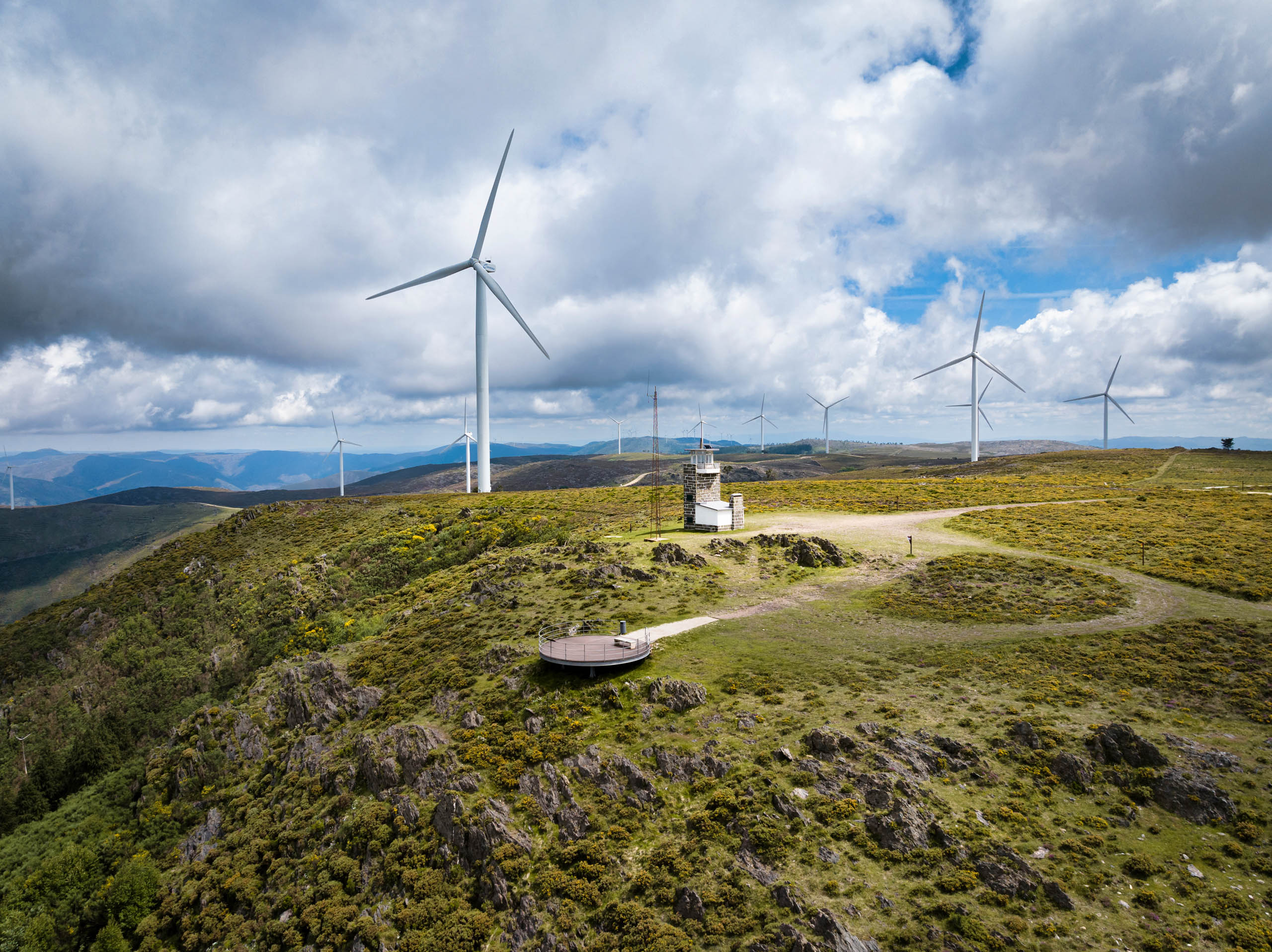
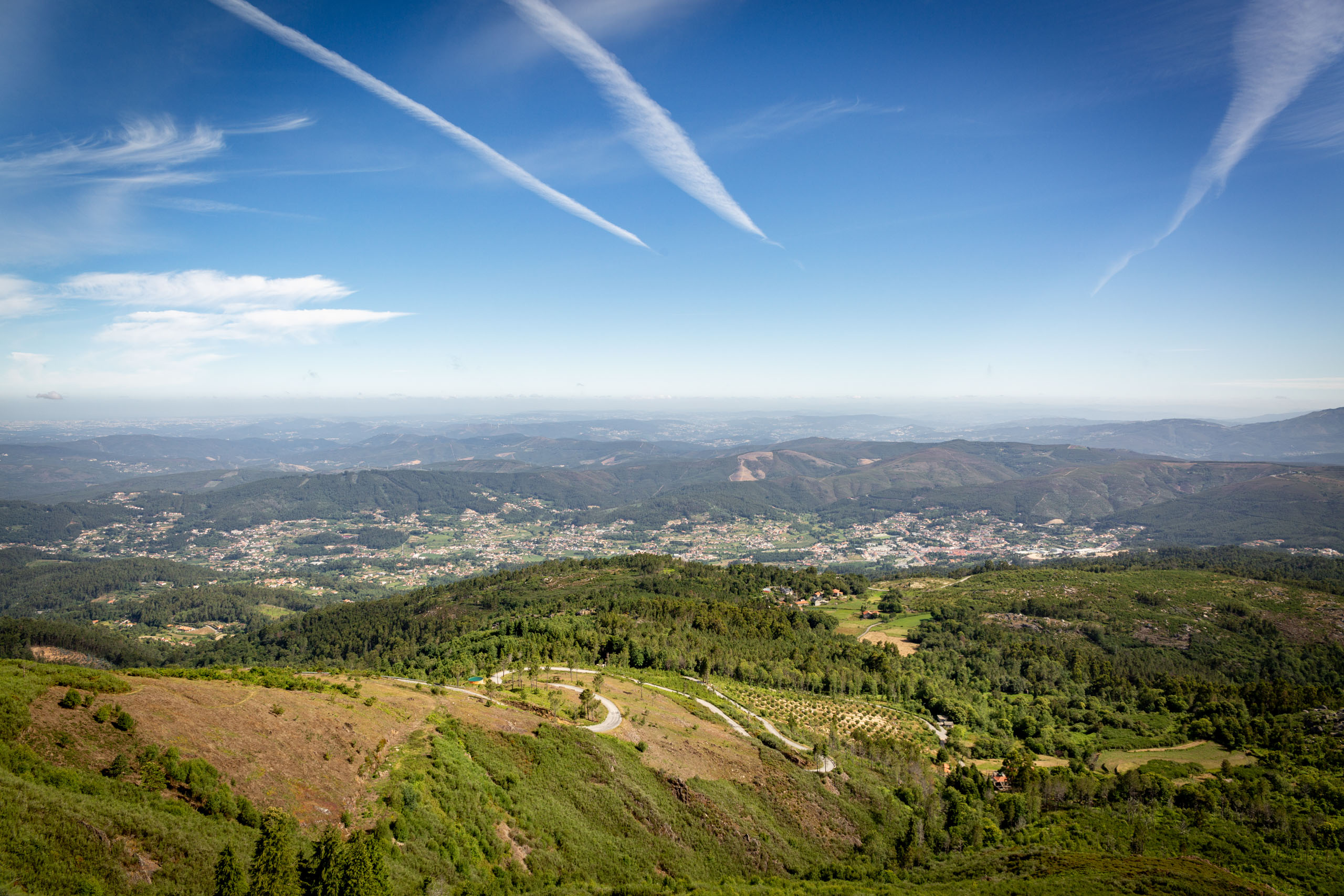
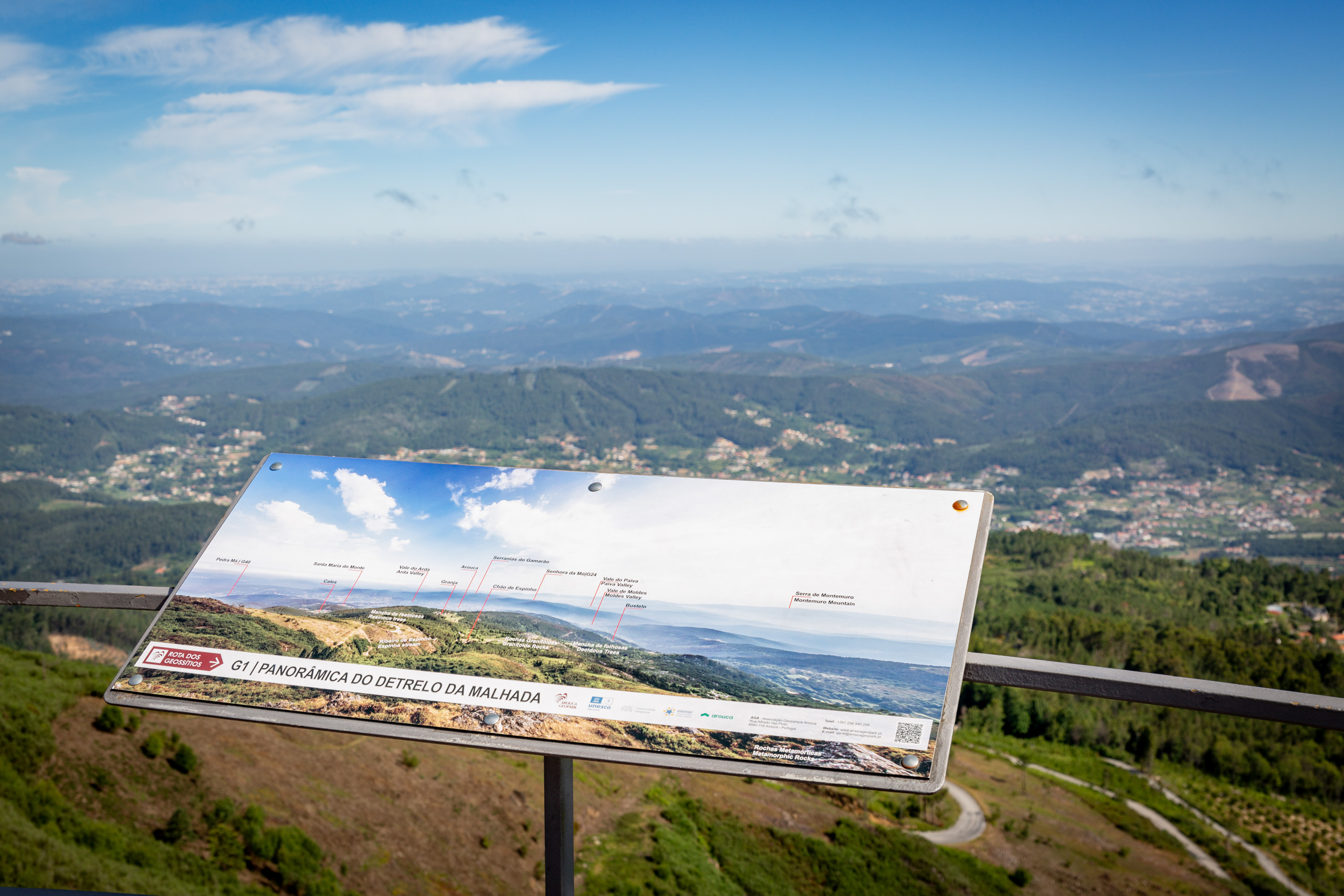
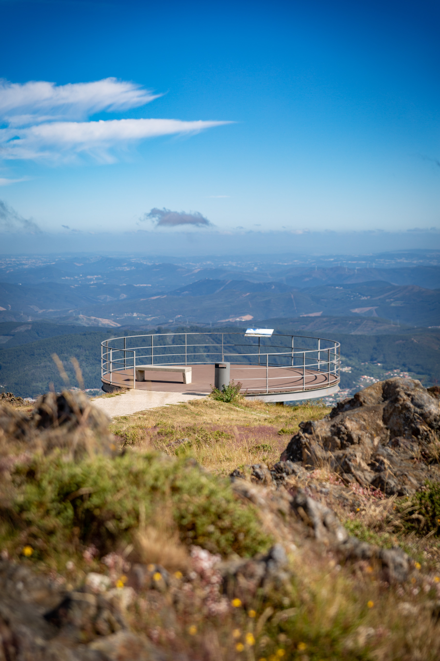
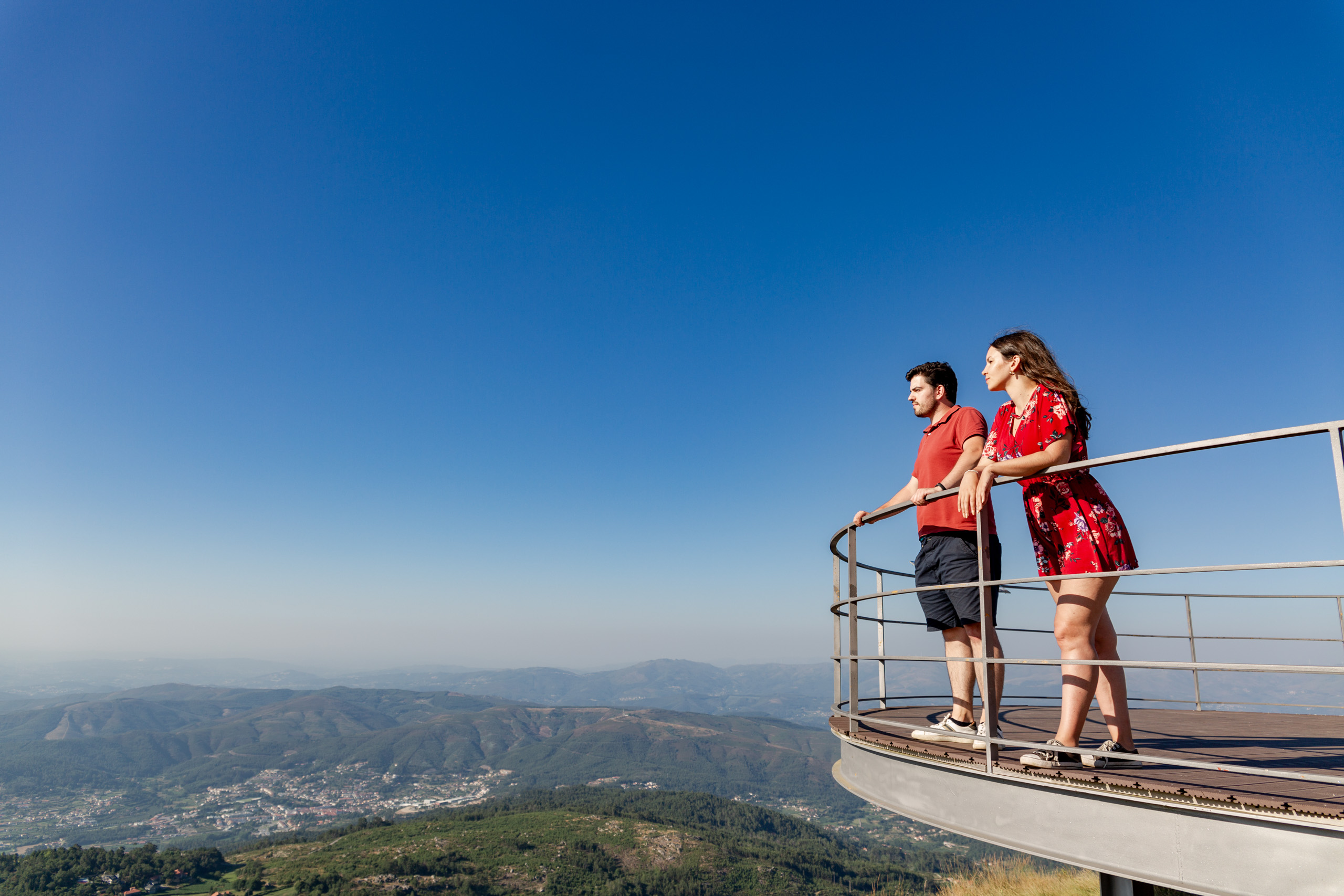
Suspended over the northern slope of the Serra da Freita, the viewpoint do Detrelo da Malhada invites us to admire the mountainous landscape of northern Portugal. Nearby lies the highest point of the Serra da Freita. From here, on clear days, it is possible to see the Serra do Marão, the mountain ranges that make up the Parque Nacional da Peneda-Gerês and the Parque das Serras do Porto. To the west, the mountainous zone gives way to the coastline, highlighting the urban areas of the cities of Porto, Vila Nova de Gaia, Espinho and Santa Maria da Feira, bordered by the Atlantic Ocean. Directly ahead, the mountain slope descends into the vale de Arouca, where the historic centre developed and grew around the Mosteiro de Arouca, flanked by fertile agricultural land nourished by the waters of the rio Arda and its tributaries. Senhora da Mó rises between the vale de Arouca and the vale de Moldes, to the east, and shelters the vale do Paiva to the northeast.
One of the geotouristic walking routes of the Arouca Geoparque Mundial da UNESCO passes through this geosite. Classified as a Short Route, the PR16 is 12 km long, circular in shape, and takes you through the granitic landscape of the planalto da Freita. This site also hosts the legendary trail races Maratona Filhos da Freita, Dolorosa de Moldes, and Ultra Trail da Serra da Freita.
This geosite is part of the itinerary A: Freita, A Serra Encantada.
Learn more about the Geosites Route .
Geological Information
The circular viewpoint of Detrelo da Malhada rests upon metamorphic rocks: spotted schists (schist-greywacke metasediments) that stand vertically, as if they were protective walls of the Serra da Freita.
The steep northern slope of the Serra da Freita and the fertile valley of the rio Arda (where the town of Arouca is located) stretch out before us. The vale de Arouca (geomorphologically known as the alvéolo complexo de Arouca) is carved into a magmatic rock – the quartzodiorite de Arouca, which is highly susceptible to chemical weathering. Its floor has accumulated sediments resulting from the erosion of the surrounding mountains, which were retained here largely due to the hardness and erosion resistance of the Pedra Má (a hornfels rock located on the border between the parishes of Rossas and Várzea), a geosite of the Arouca Geoparque Mundial da UNESCO, situated along the Ecovia do Arda.
The incision of the rio Arda (part of the Douro River Basin), which occurred at the end of the Cenozoic, as well as the formation of the fertile soils in the valley we see today, was crucial for the establishment of the Mosteiro de Arouca, and for the development of this territory.
The view over the northern slope of the Serra da Freita reveals different erosion levels, which demonstrate the movement and displacement of the blocks that uplifted the Serra da Freita. It is possible to distinguish, with some clarity, the contact between the metasediments and the quartzodiorite de Arouca, marked by differences in both relief and vegetation.
The emplacement of the quartzodioritic pluton induced significant contact metamorphism, evidenced here by the presence of spotted schists.
Interests
Use
Relevance
Coordinates Detrelo da Malhada
Photos and Videos Gallery
Detrelo da Malhada
Detrelo da Malhada
Detrelo da Malhada
Detrelo da Malhada
Detrelo da Malhada
Experience 360º

Detrelo da Malhada