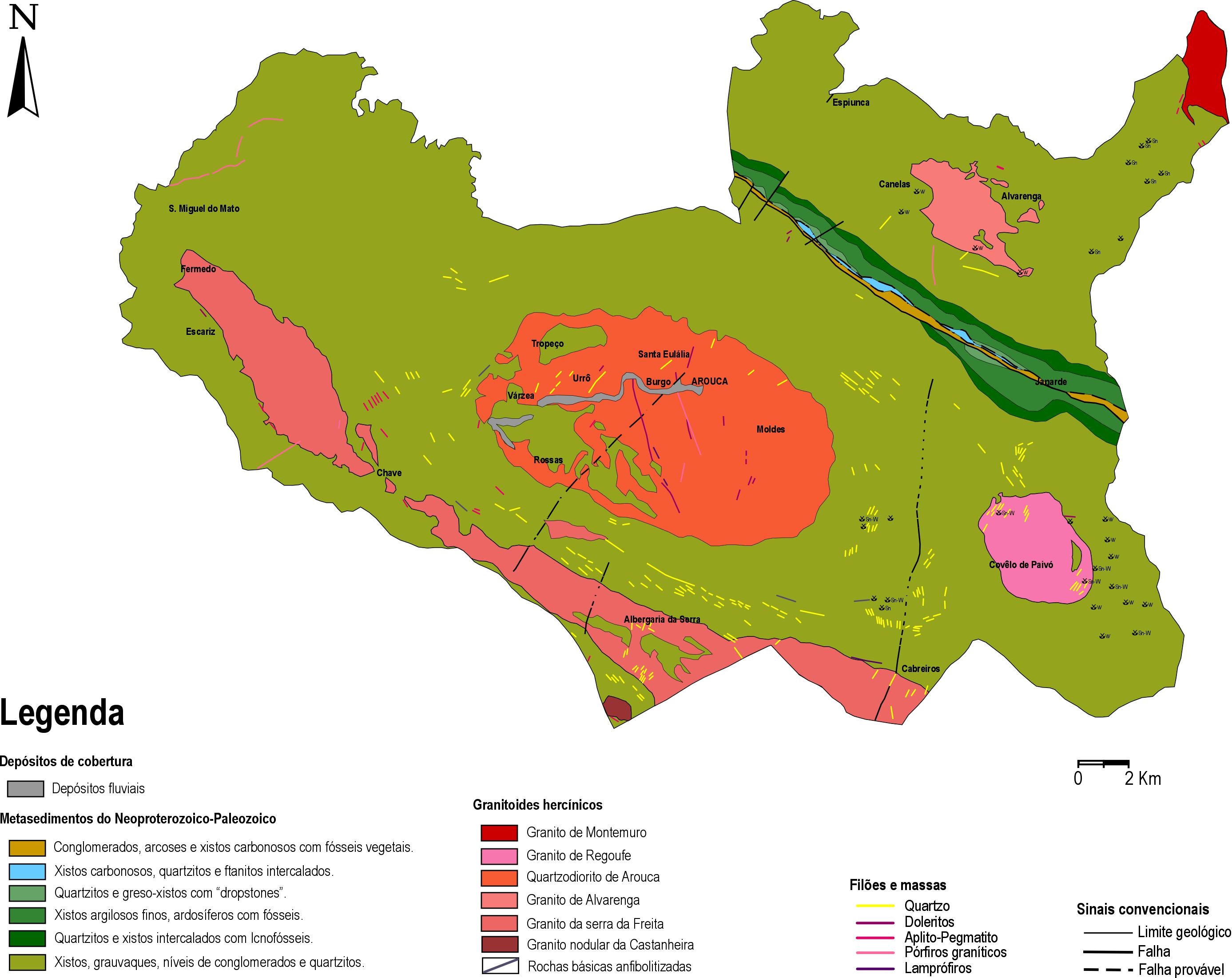
The Geosites Route is a new way of looking at tourism, science and culture in Arouca Geopark. Based on hard work in the area of the qualification and enhancement of Arouca’s Geological Heritage, a route has been structured through the history of Earth’s time, so well written in the rocks, fossils, minerals, soils and landscapes of this unique geopark and which, today, is an indelible mark of this territory!
Join this journey through the history and time of Planet Earth, which takes you to discover 31 geosites in this UNESCO World Geopark, spread over three routes:
If you’re traveling the Geosites Route on your own, we advise you to take the paper guide with you, where you’ll find simple and objective explanations of the uniqueness of the geological heritage. You can get it from our online store.
At each geosite on this route you can access additional information via the QR Code on the identification flag, the interpretive panels or the visitor support equipment.
At the main access/entry points, you will find a sign identifying the Route.
Sinal de Direção da Rota
Ao longo dos itinerários, encontrará sinais de direção, para que se mantenha na Rota.
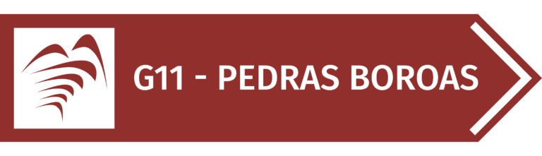
Pedestrian and/or road signs
Near the geosites on the Route, you’ll find signs for each of them, which can be accessed by road and/or by foot.
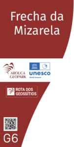
Identification flag
All the geosites on the Route are identified with a flag. On it you’ll find a QR Code that will allow you to obtain additional information about them.
Discover the Geosites
And let yourself be enveloped by the charm of a geological heritage recognized by UNESCO, where every stone tells a story and every route is a journey through time.