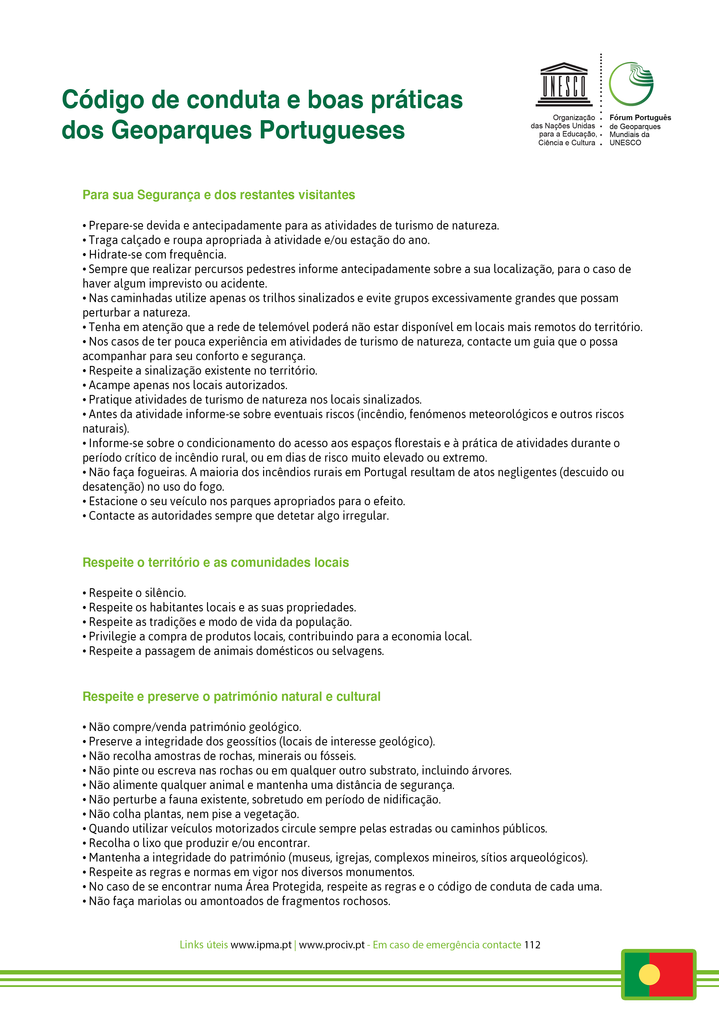
Sustainability100% Responsible
The 100% Responsible by Geoparks Programs offer a sustainable and safe tourist experience in the territories classified as UNESCO World Geoparks, promoted by partner companies.
This initiative, launched by Turismo de Portugal and the Portuguese UNESCO World Geoparks, aims to highlight the offer and involve tourism agents in promoting the Geoparks as sustainable territories committed to the United Nations Sustainable Development Goals.
The 100% Responsible by Geoparks programs integrate the principles of economic, environmental and social sustainability.
Clube do Paiva
Canoe trip on the Paiva River
Want to relax, take the kids for a walk or simply enjoy a quiet activity? Discover the banks of the River Paiva, the natural beauty of the mountains and the sounds of nature surrounding you on a beautiful canoe trip.
Start/finish point: Areinho recreational and leisure area
GPS coordinates: 40.952805, -8.177815
Activity location: Paradinha recreational and leisure area
Duration: 3h00
Distance: 3 to 5 km
Level of difficulty: easy
Includes: life jacket, helmet, guide, insurance, photo report and transfer.
Notes: activity for children aged 4 and over.
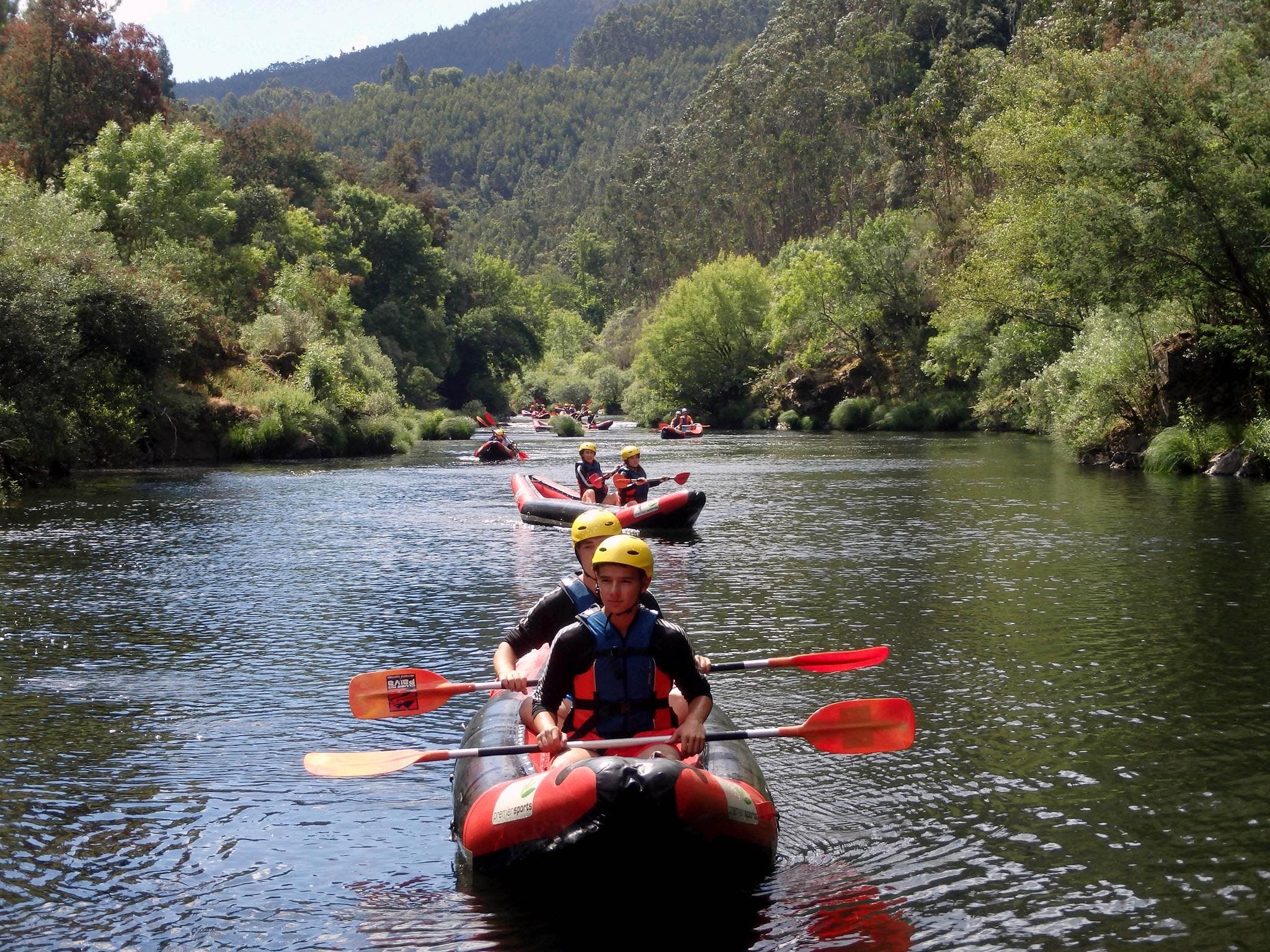
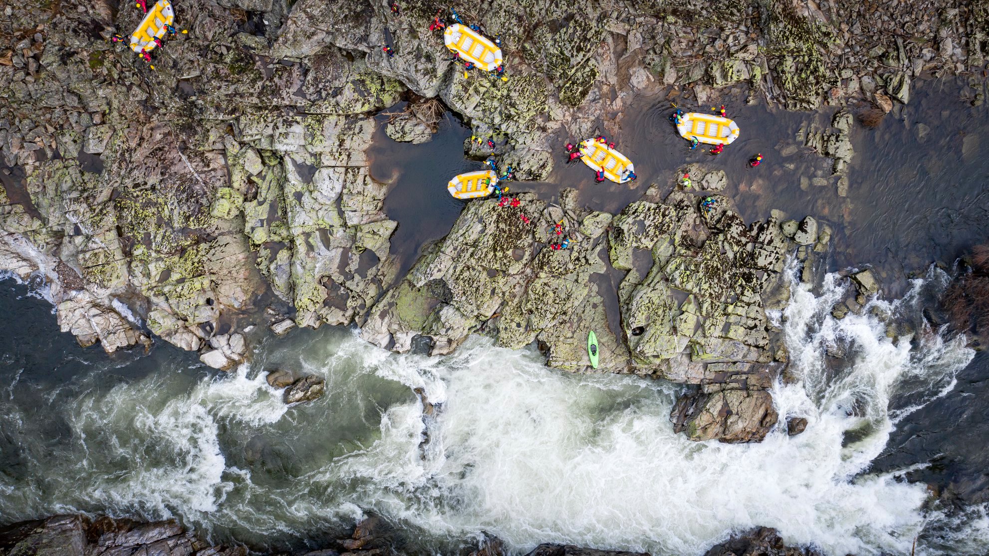
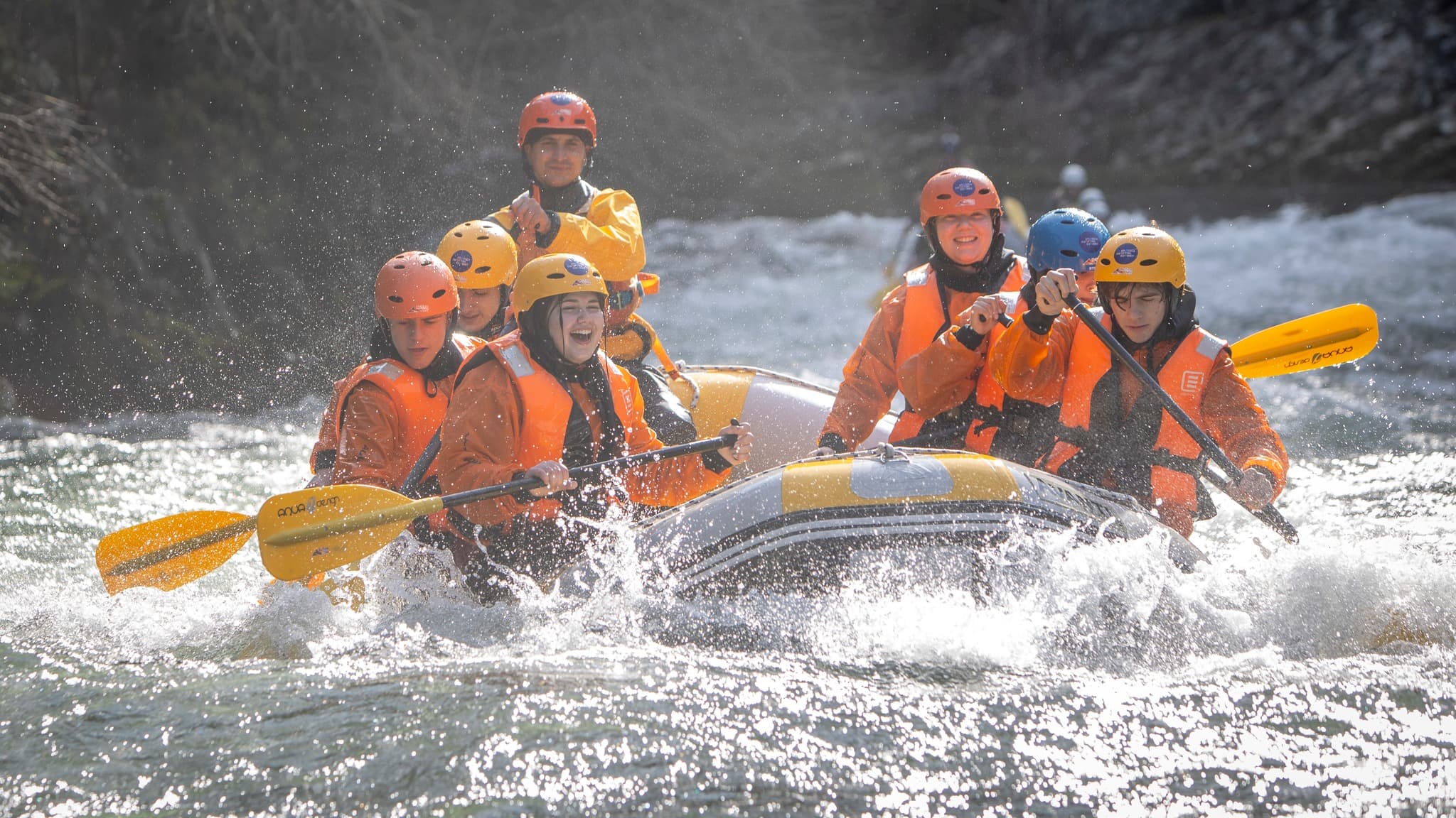
Rafting on the Paiva River
Rafting is an adventure activity in the Arouca UNESCO World Geopark, next to the Paiva Walkways. This activity is a river descent in which you can enjoy the adrenaline of the rapids created by the movement of the whitewater, as well as discovering biodiversity in the quieter moments along the way.
Start/finish point: Espiunca
GPS coordinates: 40.992944, -8.213768
Duration: 4h00
Distance: 3 to 7 km
Level of difficulty: depends on the route chosen
Includes: full equipment, guide, insurance, energy bar or snack, photo report and transfer.
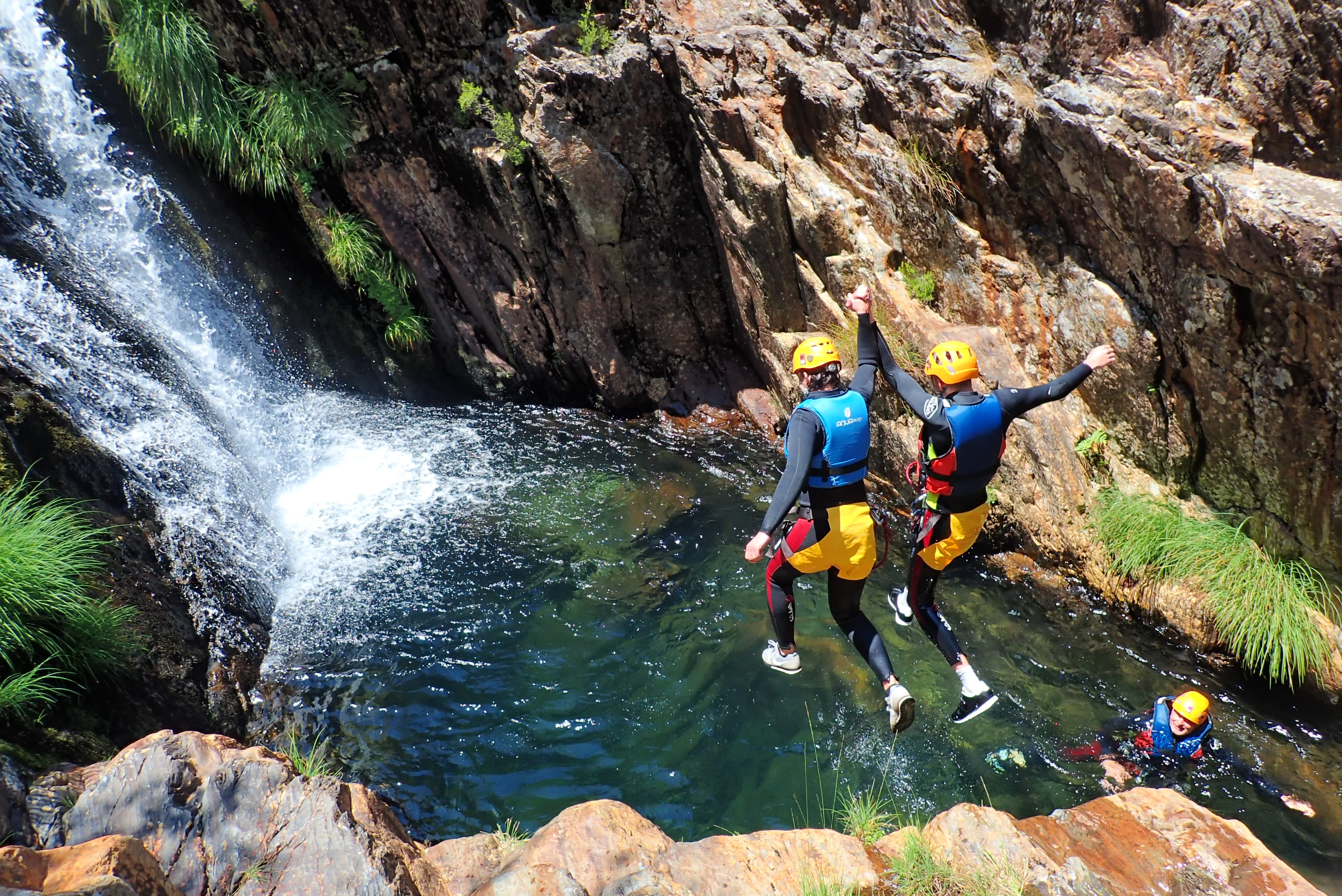
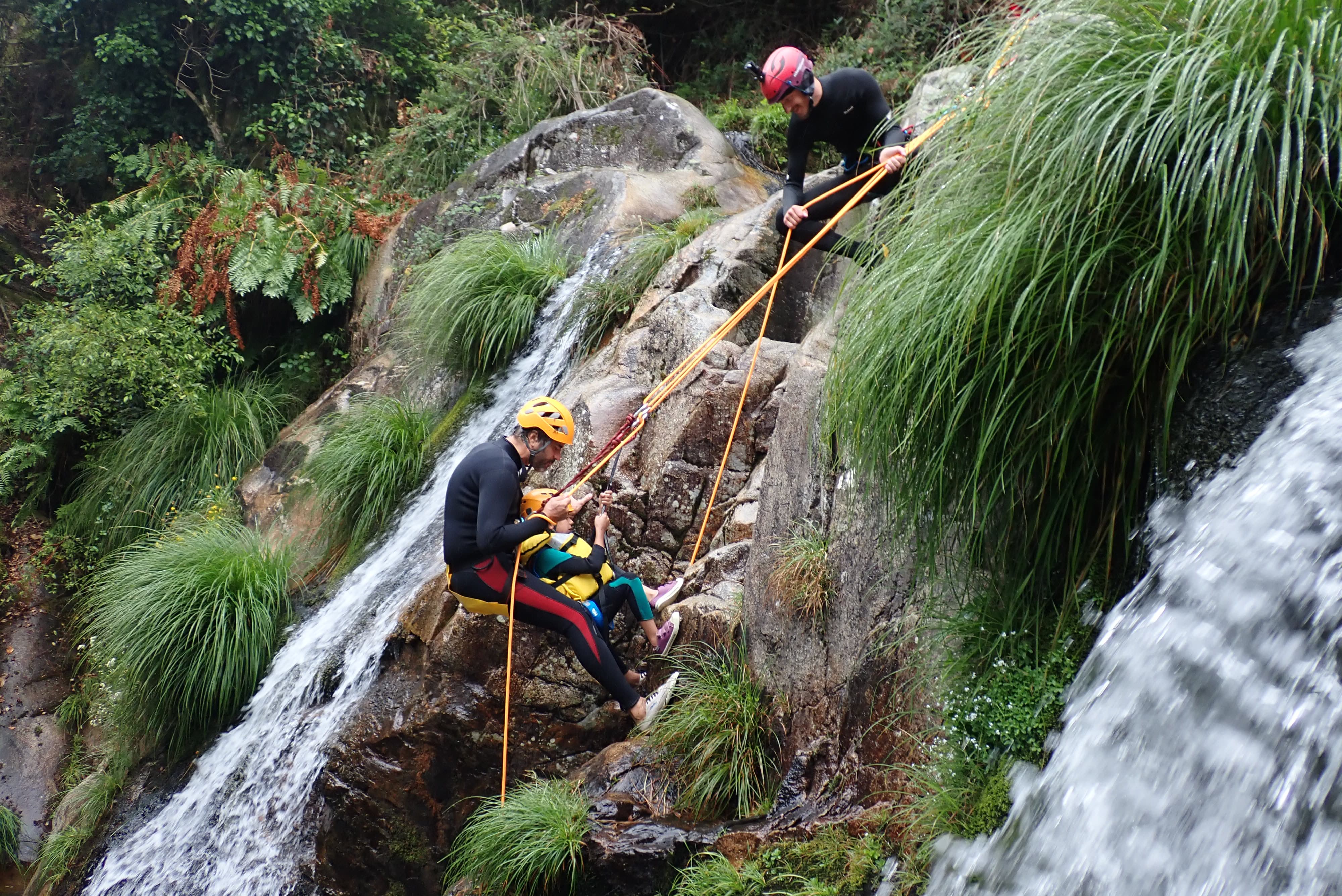
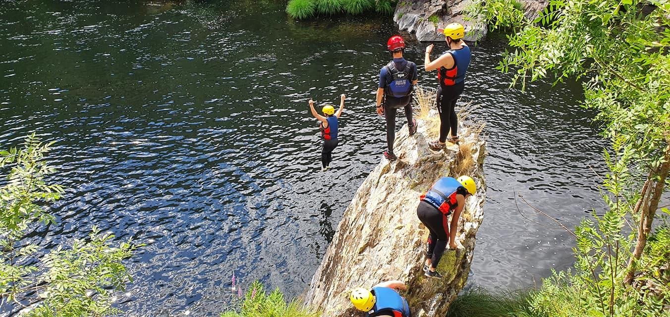
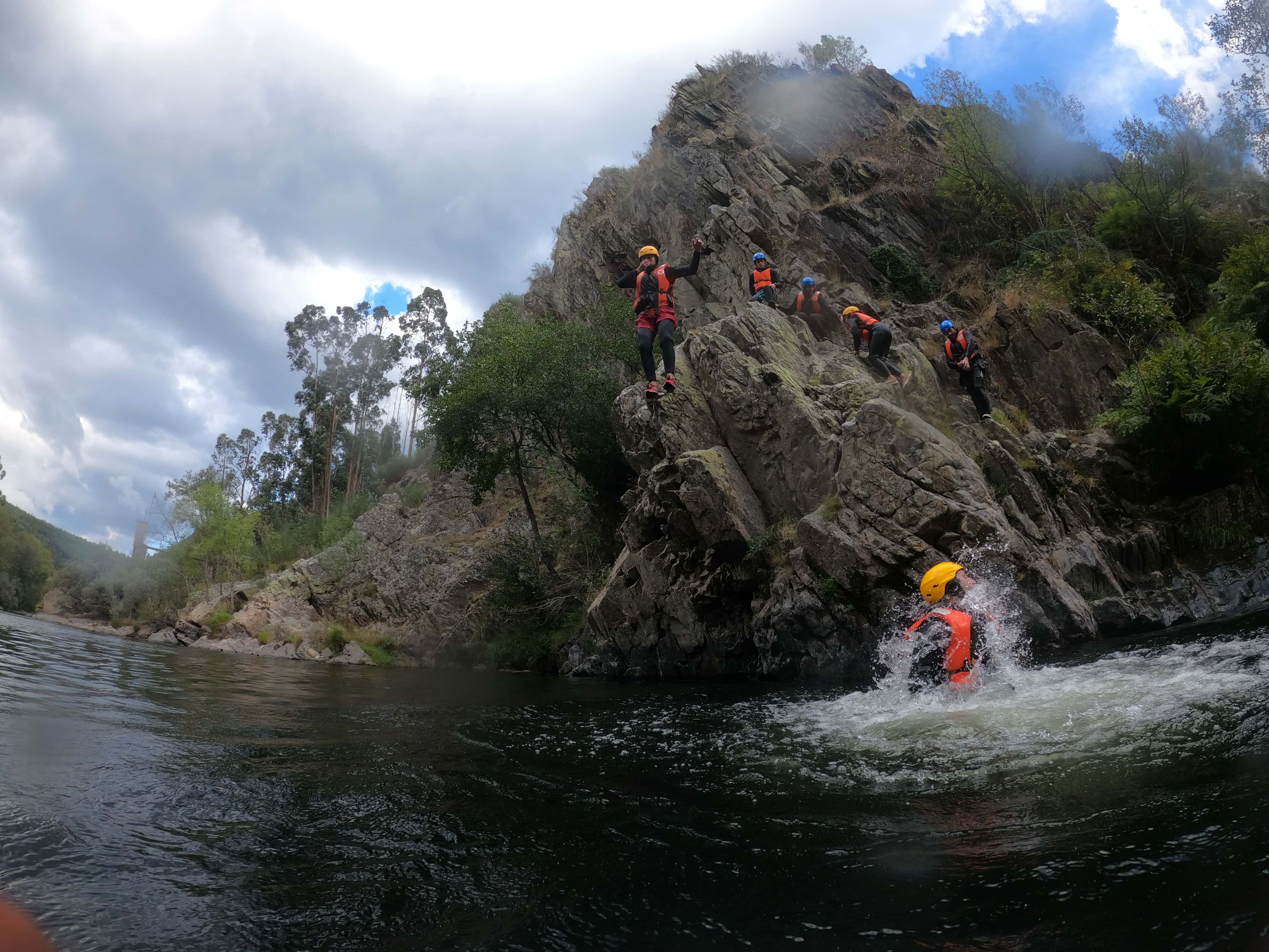
Canyoning in Arouca Geopark
Canyoning is an adventure activity that combines adrenaline and fun. The routes are suitable for children, amateurs and the more adventurous. Canyoning allows you to discover the wild waters of the Paiva River, swimming in natural pools and walking on the rocks of the Montanhas Mágicas, jumping into wells and rappelling.
Start/finish point: Arouca Town Hall
GPS coordinates: 40.928906, -8.242949
Activity location: Rio de Frades or Ribeira de Vessadas
Duration: 6h00
Distance: 3 to 7 km
Level of difficulty: easy
Includes: full equipment, guide, insurance, energy bar or snack, photo report and transfer.
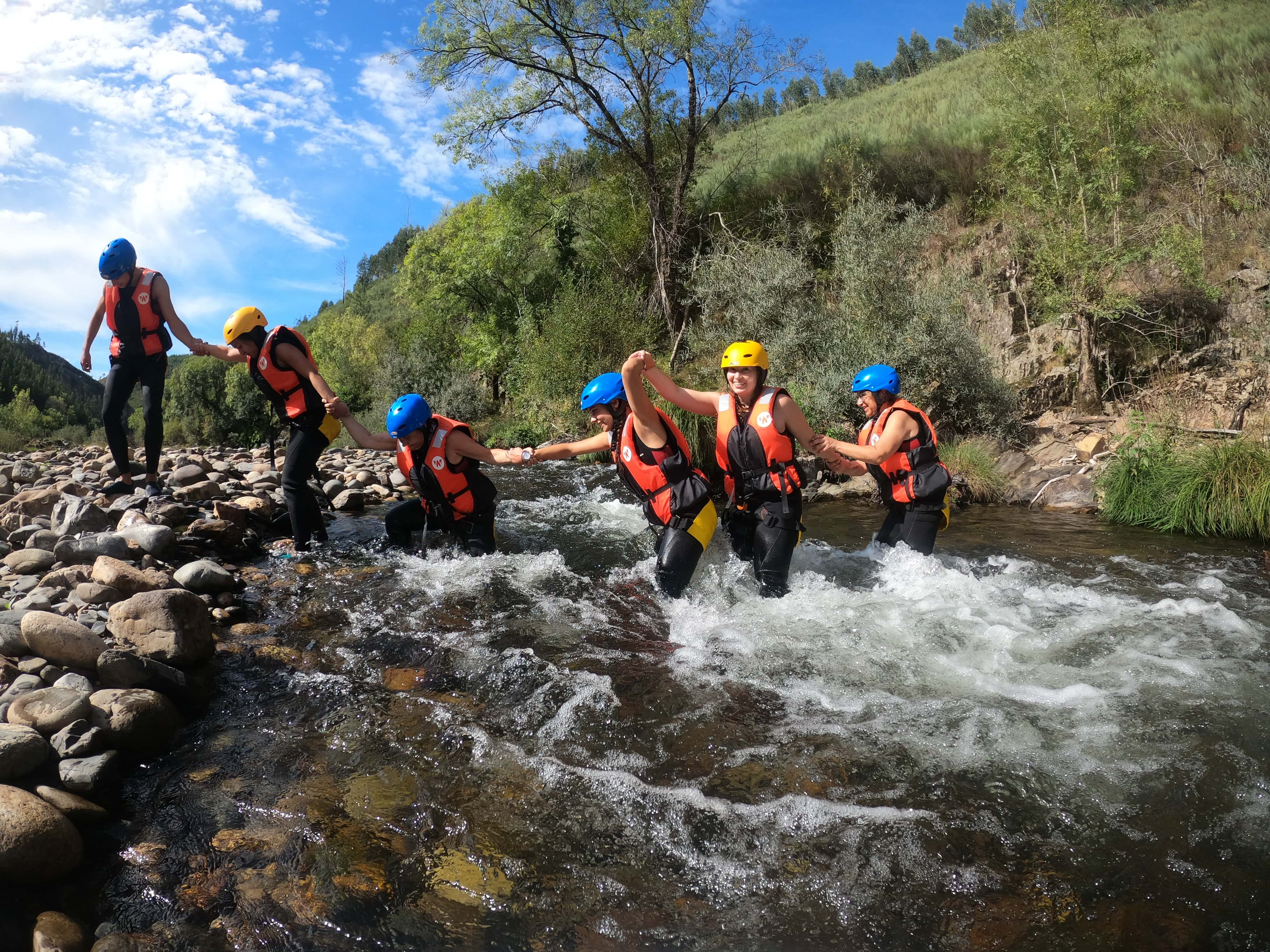
River Trekking on the Paiva River
River Trekking is an aquatic walk that will take you through the landscapes bordering the Paiva River. Walking in the water, jumping off the rocks and diving into the clear waters is the definition of this discovery. Let yourself be carried away by the river's water on an unusual adventure.
Start/finish point: Areinho recreational and leisure area
GPS coordinates: 40.952812, -8.177879
Duration: 4h00
Distance: 3 to 4 km
Level of difficulty: easy, medium
Includes: full equipment, guide, insurance and photo report.
Caminhada aquática
Canyoning
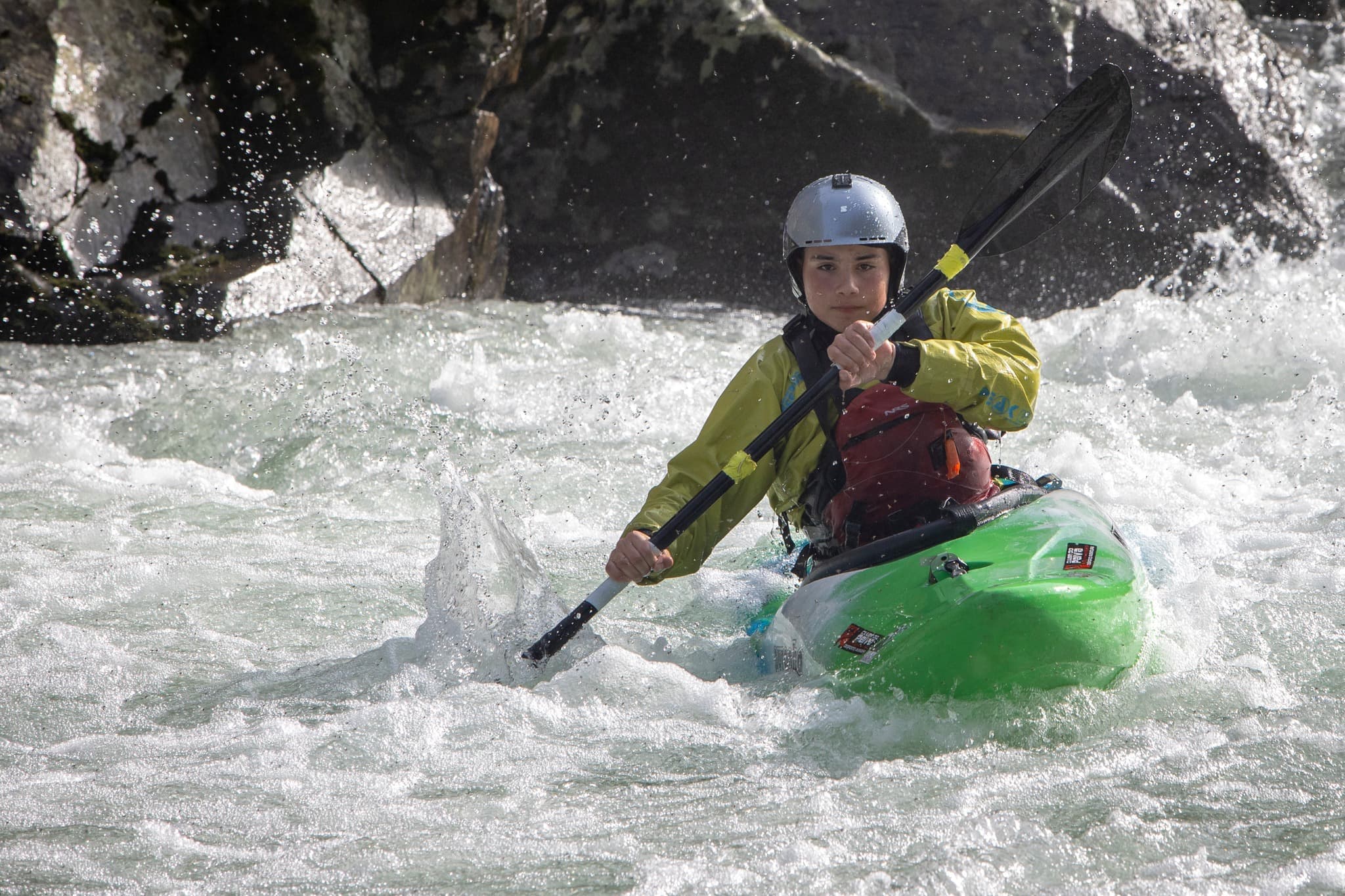
Kayak
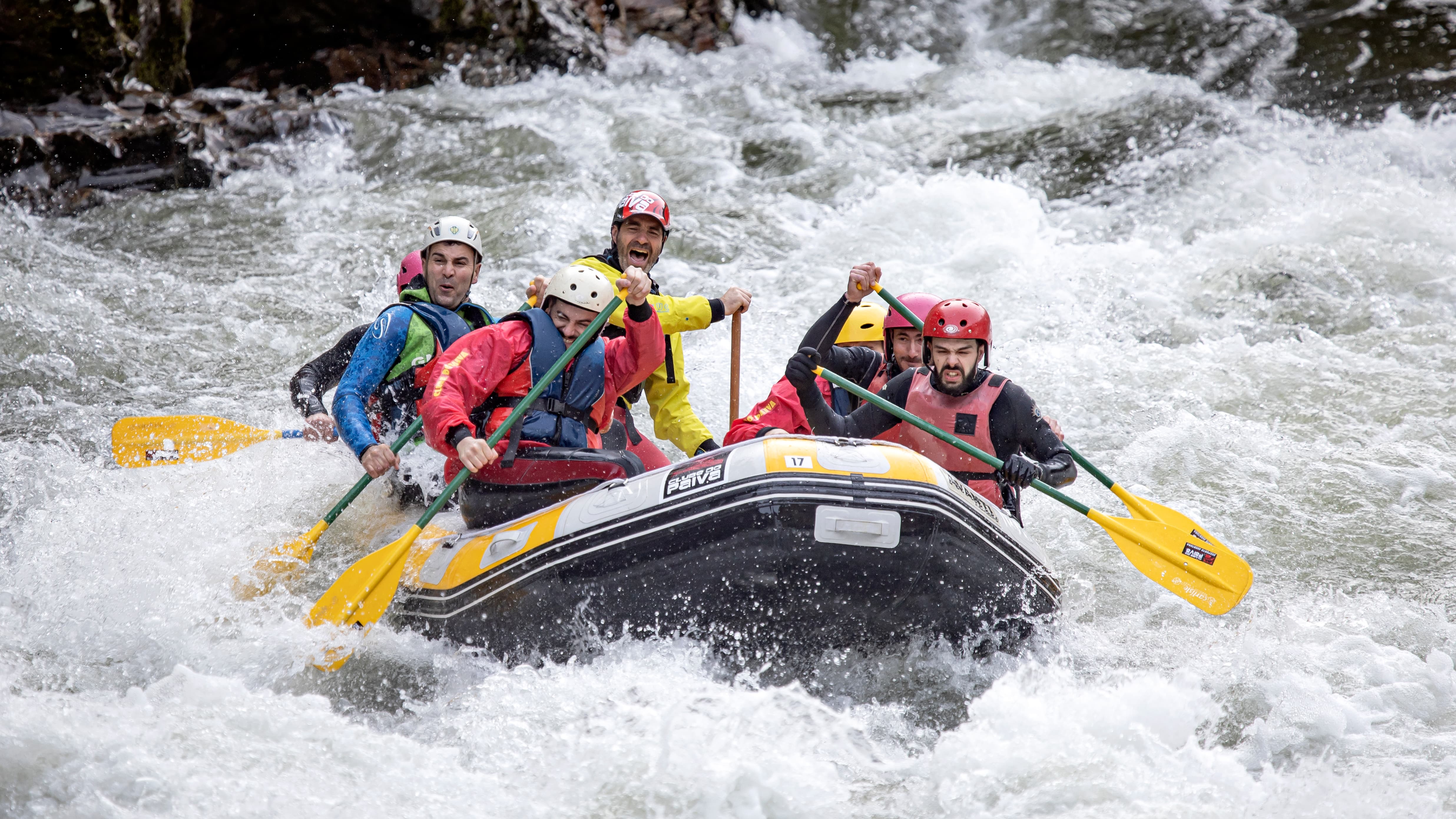
Rafting ©Avelino Vieira
Canoeing
Caminhada aquática
Caminhada aquática
Canyoning
Kayak
Rafting ©Avelino Vieira
Canoeing
Caminhada aquática
NaTour Way
Water Walk
Take a hiking trail along one of the clearest rivers in the world, the Paiva River. Accompanied by a guide, you'll feel determined to discover the best-kept corners of the river. The scenery is incredible and you can also count on an interpretation of the fauna and flora that you will encounter throughout the activity.
Start/finish point: Areinho recreational and leisure area
GPS coordinates: 40.952827, -8.176778
Duration: 4h00
Distance: 2.5 km
Level of difficulty: medium
Includes: interpreter guide, equipment for the sport and safety accessories, photo report and personal accident insurance.
Promoter: NaTour Way
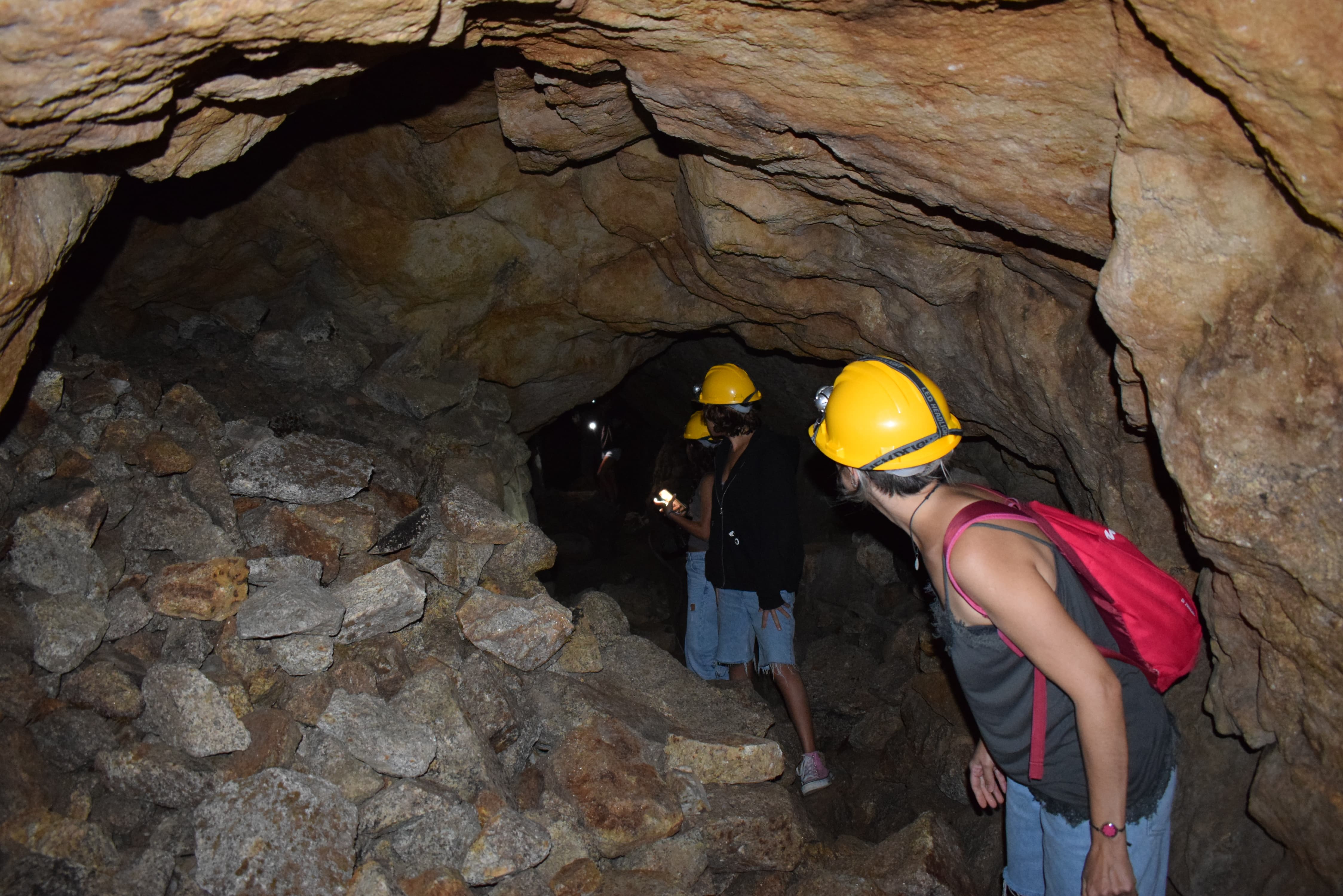
Speleology
Literally enter the “terra adentro” and get to know the underworld left behind by our recent ancestors in the exploitation of tungsten, tin and even gold. You'll learn about the method of exploitation, the applications, but also the socio-economic aspects and the influence these concessions had on the development of the region.
Start/finish point: Areinho recreational and leisure area
GPS coordinates: 40.952827, -8.176778
Duration: 4h00
Distance: 10 km
Level of difficulty: easy
Includes: interpreter guide, safety equipment for entering the mines (helmet and flashlight), transportation by Jeep, water and local snacks, photo report and personal accident insurance.
Promoter: NaTour Way
Rafting
If you like adventure sports and have a team spirit, then rafting is the water activity for you! Raft down the wild waters of the Paiva River in an inflatable boat that will guarantee you an adrenaline rush and absolute safety, thanks to the experienced instructors and the appropriate equipment, who will also help you stay comfortable throughout the journey.
Starting point: Espiunca recreational and leisure area
GPS coordinates: 40.993278, -8.214267
Arrival point: River beach at km 10, in Travanca (Cinfães)
Duration: 4h00
Distance: 8 km
Level of difficulty: medium
Includes: interpreter guide, equipment for the activity and safety accessories, transfer, snack, photo report and personal accident insurance.
Promoter: NaTour Way
https://natourway.com/rafting/
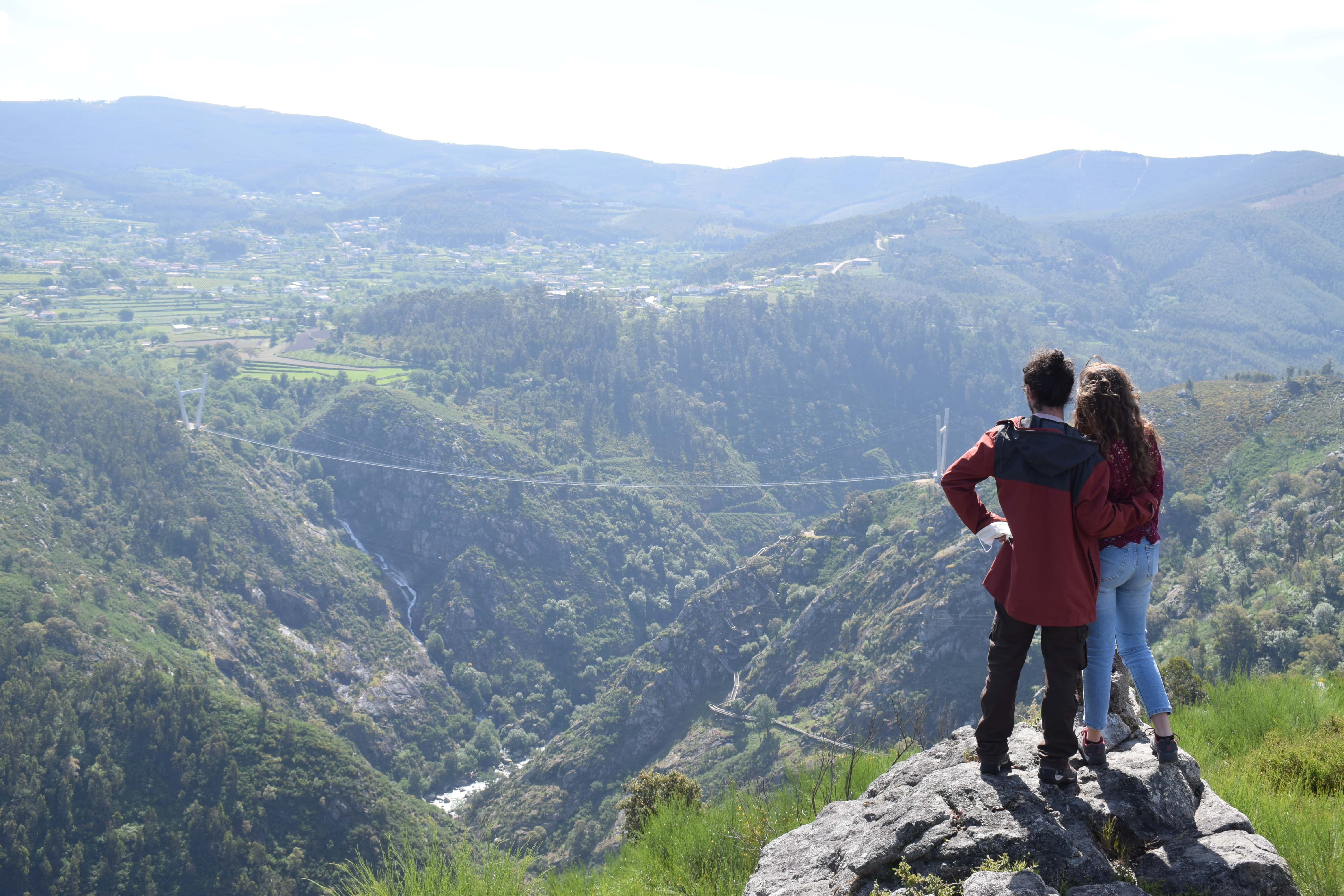
Guided Tour: Paiva Walkways and 516 Arouca
Walk along the 8 km of the award-winning Paiva Walkways, complemented by the adventurous crossing of the world's longest suspension footbridge, the 516 Arouca. Along the way, you'll be able to interpret the main points of geological interest, without forgetting the biodiversity and local stories. You can also enjoy a comforting snack of local products.
Start/finish point: Areinho recreational and leisure area
GPS coordinates: 40.952812, -8.177879
Duration: 4h00
Distance: 3 to 4 km
Level of difficulty: easy, medium
Includes: full equipment, guide, insurance and photo report.
Caminhada aquática
Caminhada aquática
NaTour Way – Rafting
NaTour Way – Espeleologia
NaTour Way – Espeleologia
NaTour Way – Rafting
Caminhada aquática
Caminhada aquática
NaTour Way – Rafting
NaTour Way – Espeleologia
NaTour Way – Espeleologia


