Geosite 4 Marmitas from Gigante do Caima
Where the water shapes the stone…
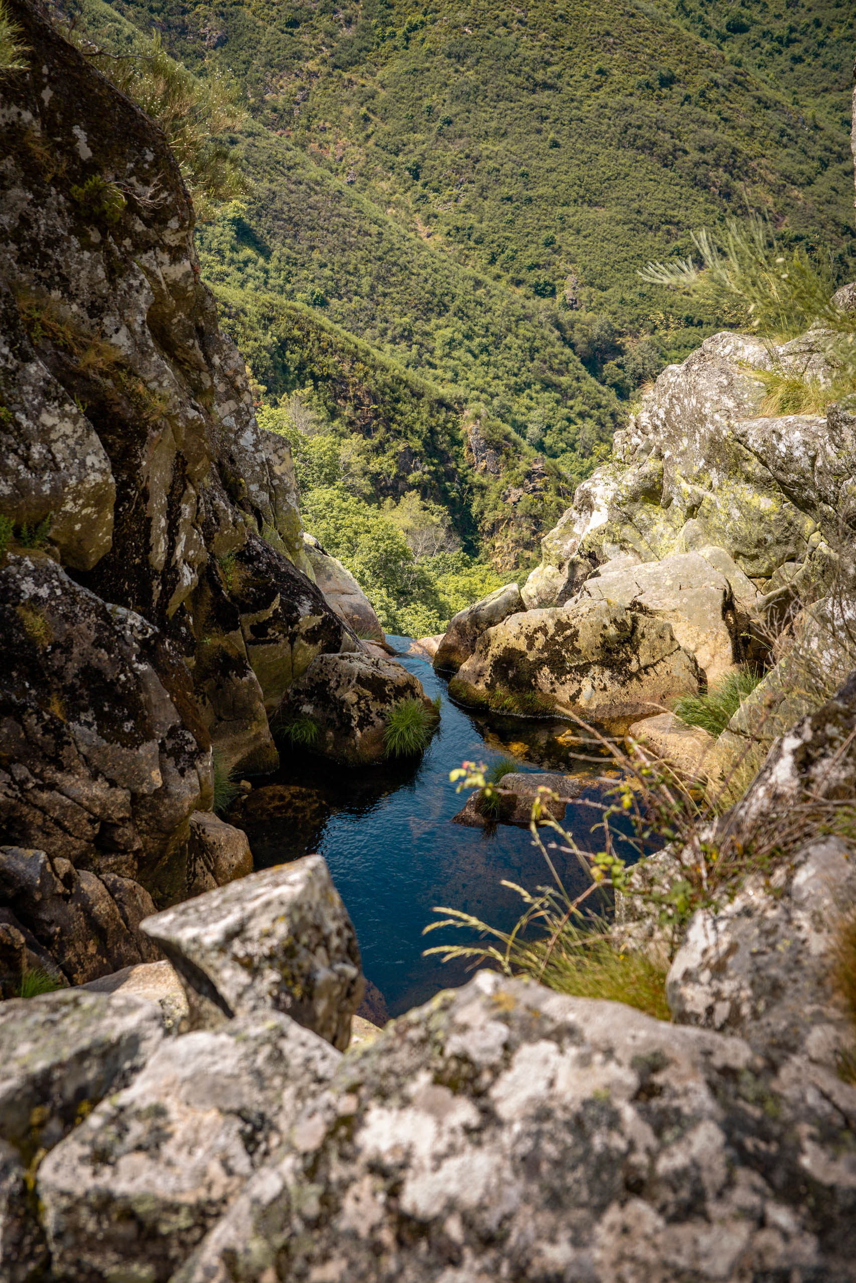
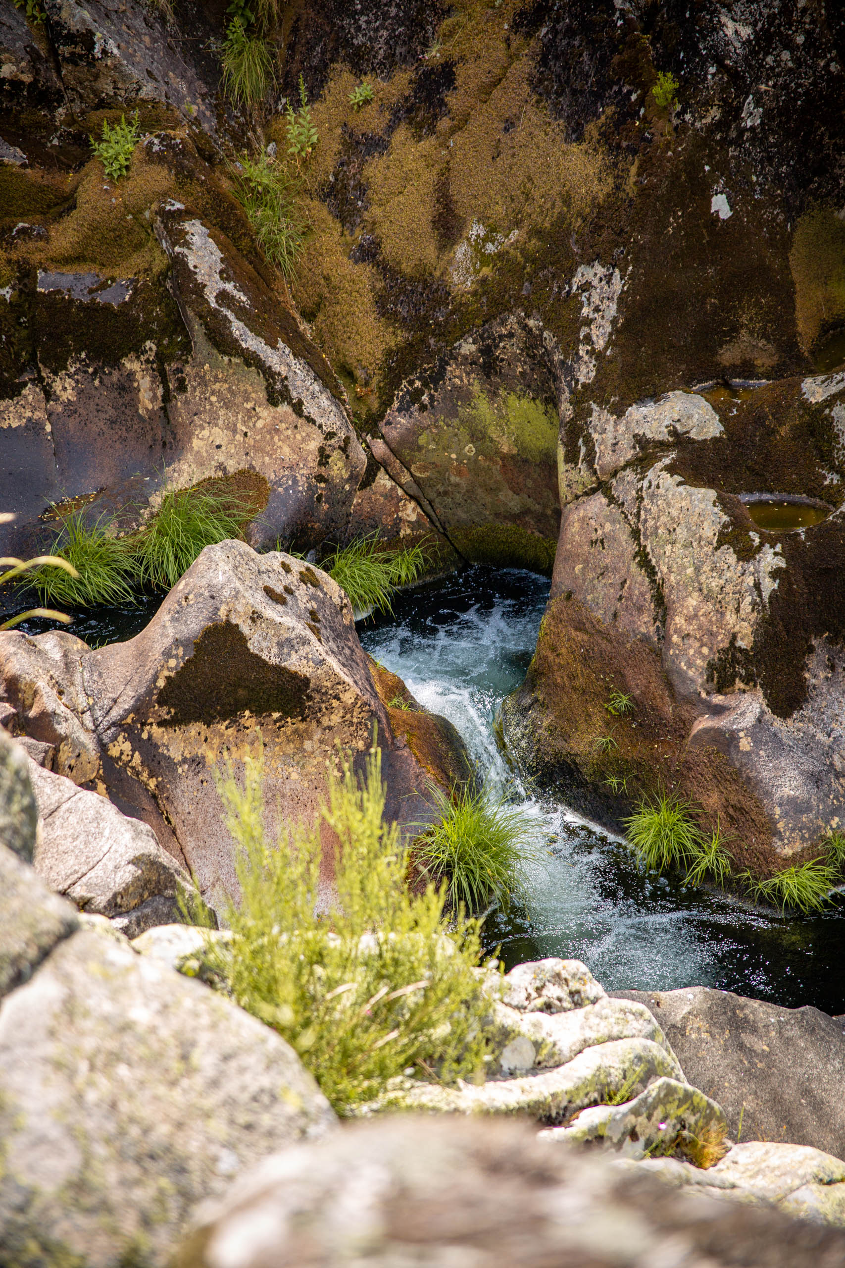
People often say that “constant dripping wears away the stone.” This is exactly what happens with the marmitas de gigante: depressions found in the rocky bed of the river. These structures result from the dynamics generated after periods of rain, which cause the flow of the rio Caima to increase. As a consequence, the energy of the water becomes greater and capable of transporting sands and rock blocks of various sizes (sediments).
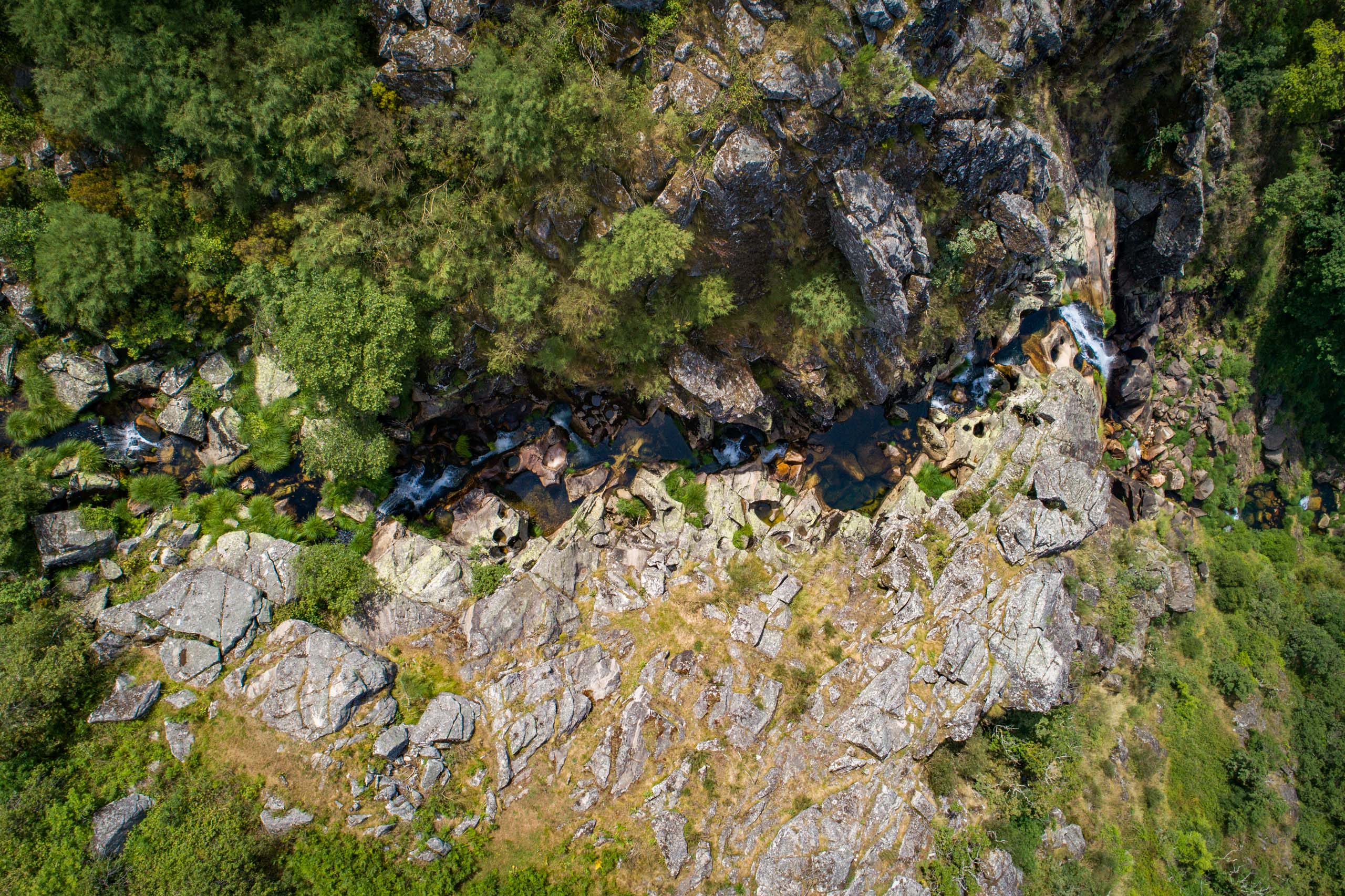
As you walk along the valley of the river, from the bridge over the rio Caima to the village of Mizarela, it is possible to observe that the Marmitas de Gigante form in granite rock, becoming increasingly numerous, wider, and deeper as we approach the point where the waterfall of Frecha da Mizarela occurs. The rio Caima, which forms not far from here from the confluence of several water lines of the inland plateau, eventually flows into the rio Vouga. The trail race Maratona Filhos da Freita also passes through here.
Geological Information
The marmitas originate from irregularities in the rocky riverbed that develops upstream of the Frecha da Mizarela waterfall, over the Granito da Serra da Freita — a leucocratic to mesocratic rock, with phaneritic texture and medium grain, around 310 million years old. These irregularities trap some sediments nearby. The accumulation of sediments then causes a swirling movement of water, whose kinetic energy promotes a circular motion. Gradually, due to friction, the sediments carve more or less circular depressions into the bed of the rio Caima, where they remain trapped.
Over time, the depressions grow larger, and the pebbles inside them tend to become smaller and more rounded. These depressions always face upwards and may appear alone or in groups, along a fracture line. In the latter case, over time, the depressions may merge to form water drainage channels.
Interests
Use
Relevance
Coordinates Marmitas from Gigante do Caima
Photos and Videos Gallery
Marmitas de Gigante do Caima
Marmitas de Gigante do Caima
Marmitas de Gigante do Caima